


|
|||
|
Discover the origin of the ‘Aquae Patavinae’ and the history of the Euganean thermal area...
|
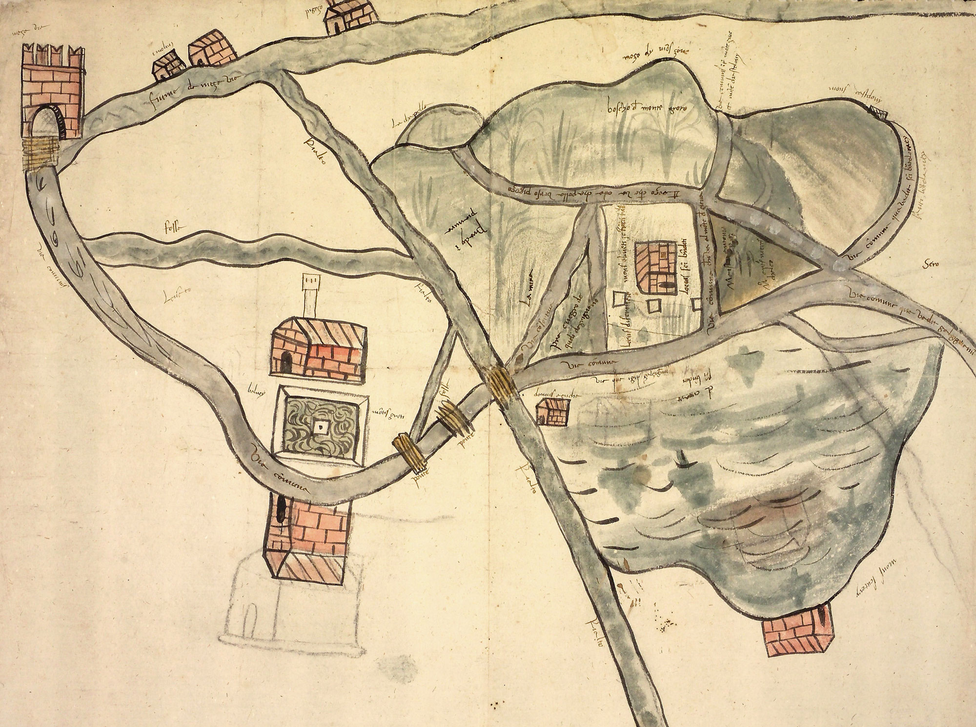
Cartographic dossier n°1One of the most ancient cartographic representations of the built-up area of Montegrotto, year 1530The map represents the hydraulic network between Mezzavia and the portion of Montegrotto’s territory embracing the present-day via Neroniana and the first Euganean hills. Mezzavia is recognizable by the presence of Palazzo Avogadro, the high crenellated building located in the top left-hand corner of the drawing: the Palace was built in the 16th century as a good checking post, and tore down in 1935 in order to widen the road leading from Padova to Battaglia; the “fiume de Meza Via”, today Canale Battaglia, flowed under the bridge on which the Palace lay. La riproduzione del documento sottostante è stata eseguita dalla Sezione di Fotoriproduzione dell’Archivio di Stato di Padova su concessione del Ministero per i Beni e le Attività Culturali, Archivio di Stato di Padova n. 07/2013 del 22/05/2013 Prot. n. 01616 Cl. 28.13.07/1.2  Dal Cortivo… |
||
|
|
|||