


|
|||
|
Discover the origin of the ‘Aquae Patavinae’ and the history of the Euganean thermal area...
|
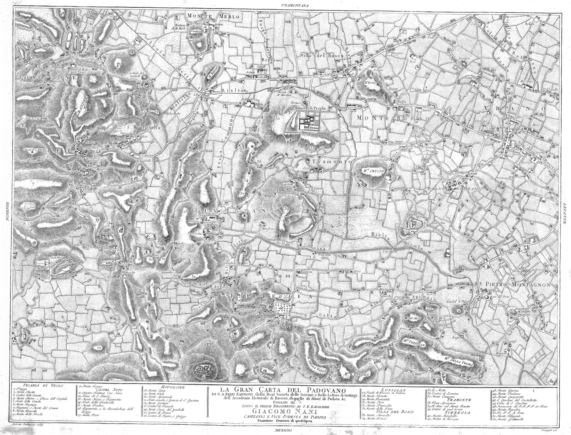
Cartographic dossier n°4Giovanni Antonio Rizzi Zannoni, GRAN CARTA DEL PADOVANO DELLA REALE SOCIETA’ DELLE SCIENZE E DELLE LETTERE DI GOTTINGA, DELL’ACCADEMIA ELETTORALE DI BAVIERA, DI QUELLE DI ALTORE, DI PADOVA.FOGLIO III. SOTTO IL FELICE REGGIMENTO DI S. E. KAVALIERE GIACOMO NANI, CAPITANIO E VICE PODESTA’ DI PADOVA, PROMOTORE GENEROSO DI QUEST’OPERA (1781)Towards the year 1778, the Paduan astronomer and cartographer Giovanni Antonio Rizzi Zannoni launched the creation of a big map of the Paduan territory on a 1:20.000 scale; the map was forecasted to be made up of twelve sheets, but only four of them were printed. This map, based on a regular triangulation, is one of the first products of the modern Italian cartography.  Alcune pezze di terra esistenti in San Pietro Montagnon (1794)…  Carta militare topografico-geometrica del Ducato di Venezia (1798 – 1805)… |
||
|
|
|||