


|
|||
|
Discover the origin of the ‘Aquae Patavinae’ and the history of the Euganean thermal area...
|
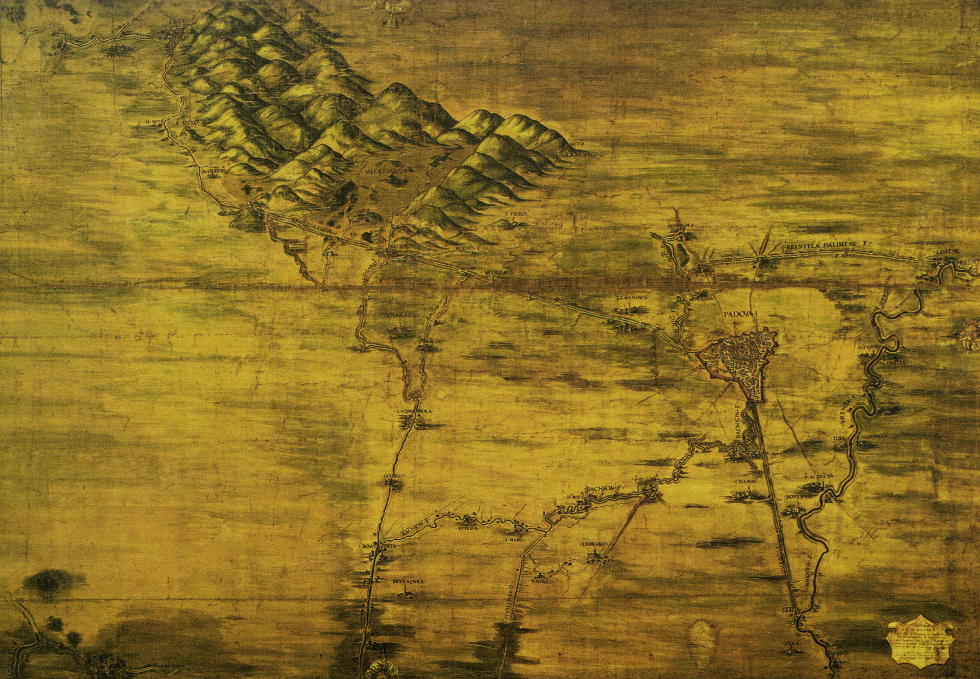
Cartographic dossier n°2Nicolò Dal Cortivo, CARTA DEL TERRITORIO PADOVANO, anno 1534This drawing is the detail of a big map of the Paduan territory between the rivers Brenta and Adige; in the middle, we can see the lay-out of the Euganean thermal area before the reclamation works dating from the second half of the 15th century: as a matter of fact, it is possible to recognize several areas of water stagnation in the proximity of Monselice, Battaglia and Galzignano. The watercourse connecting the two “lands” of Este and Monselice is visible in close-up, and reaches the residential area of Padova – represented with its city walls and the related hydrography. The built-up area of San Pietro and the centres of Mezzavia, Mulini and M. Ortone (“Artone”) are clearly identifiable, as well as the winding and active course of the river Rialto. La riproduzione della mappa sottostante è stata eseguita dalla Sezione di fotoriproduzione dell’Archivio di Stato di Venezia ed è stata pubblicata con atto di concessione n. 51/2013 e Prot. n. 5802 del 01.08.2014.  One of the most ancient cartographic representations of the built-up area of Montegrotto (1530)…  Gran Carta del Padovano della Reale Società delle Scienze e delle Lettere di Gottinga (1781)… |
||
|
|
|||