


|
|||
|
Discover the origin of the ‘Aquae Patavinae’ and the history of the Euganean thermal area...
|
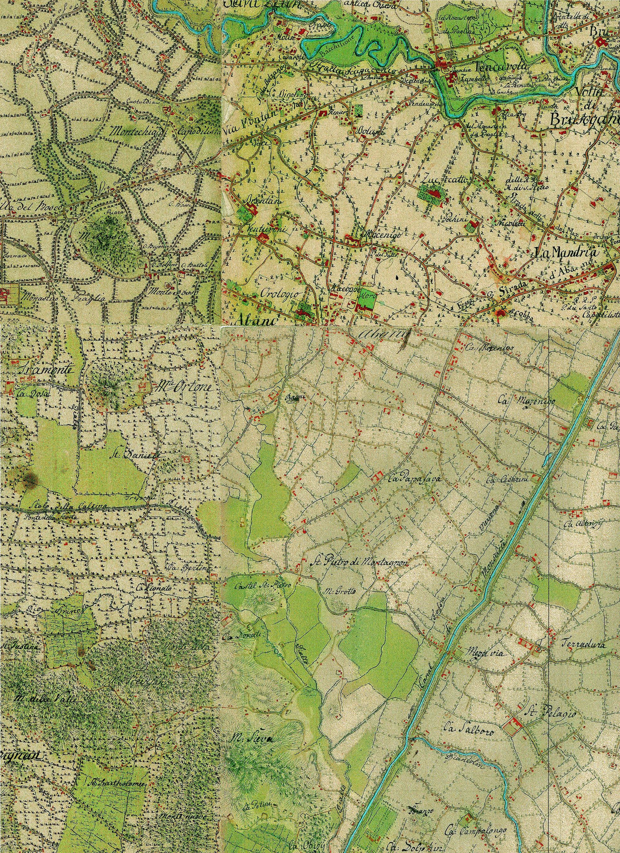
Cartographic dossier n°5Anthon von Zach, KRIEGSKARTE. TOPOGRAPHISCH-GEOMETRICHE KRIEGSKARTE VON DEM HERZOGTHUMS VENDIG (1798 – 1805)After the signing of the Campoformido Treaty (1797), the Venetian possessions passed under the rule of the Hapsburg, and the army staff officers charged the General Anton von Zach with the creation of a topographic large-scale map aimed at military purposes. The surveying was carried out from 1798 and 1805, and the final result was a very detailed and vast topographic map, the “Kriegskarte”, which became the war map of the Austrian Empire. The most recent reproduction of the “Krigskarte” can be found in: Kriegskarte, 1798-1805. Il Ducato di Venezia nella carta di Anton von Zach/Das Herzogtum Venedig auf der Karte Antons von Zach a cura di Massimo Rossi, Fondazione Benetton Studi Ricerche-Grafiche V. Bernardi (in collaborazione con Österreichisches Staatsarchiv Kriegsarchiv, Vienna) Treviso-Pieve di Soligo 2005.  Gran Carta del Padovano della Reale Società delle Scienze e delle Lettere di Gottinga (1781)… 
Mappa del territorio di San Pietro Montagnone – Catasto Napoleonico (1810)… |
||
|
|
|||