


|
|||
|
Discover the origin of the ‘Aquae Patavinae’ and the history of the Euganean thermal area...
|
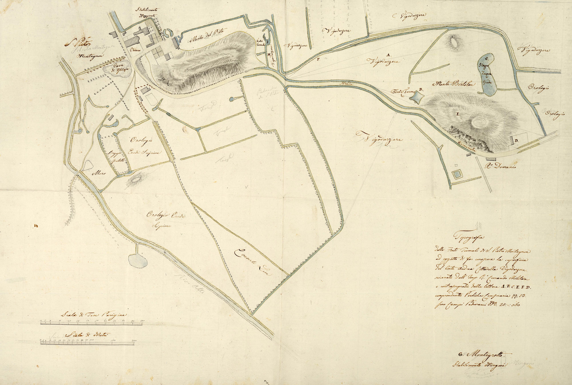
Cartographic dossier n°8Giuseppe Maria Pivetta, TOPOGRAFIA DELLE FONTI TERMALI DI S. PIETRO MONTAGNON AD OGGETTO DI FAR CONOSCERE LA SUPERFICIE DEL CONTE ANDREA CITTADELLA VIGODARZERE, anno 1834Towards the year 1836 the engineer Giuseppe Maria Pivetta, in charge of surveying the state-owned properties of the province of Padua, provided an accurate plan of the holdings owned by the Count Andrea Cittadella Vigodarzere, located between the “Monte del Prete”, where today the parish of San Pietro in Montegrotto lies, and Colle Bortolone. The map represents with complete accuracy the road system, the subdivision of the holdings with the name of the landholders, the buildings, the baths, and the numerous stretches of water originated from thermal springs. The most significant element provided by this document is the representation of little water courses and pools. The pools were very abundant in this portion of land, and could either have a natural aspect or be inserted into circular or quadrangular permanent retaining structures. Letters B and I locate two thermal springs, letter C locates a pond of cold water. La riproduzione del documento sottostante è stata eseguita dalla Sezione di Fotoriproduzione dell’Archivio di Stato di Padova su concessione del Ministero per i Beni e le Attività Culturali, Archivio di Stato di Padova n. 07/2013 del 22/05/2013 Prot. n. 01616 Cl. 28.13.07/1.2 
Mappa del Comune censuario di San Pietro Montagnone – Catasto austriaco (1834)… |
||
|
|
|||